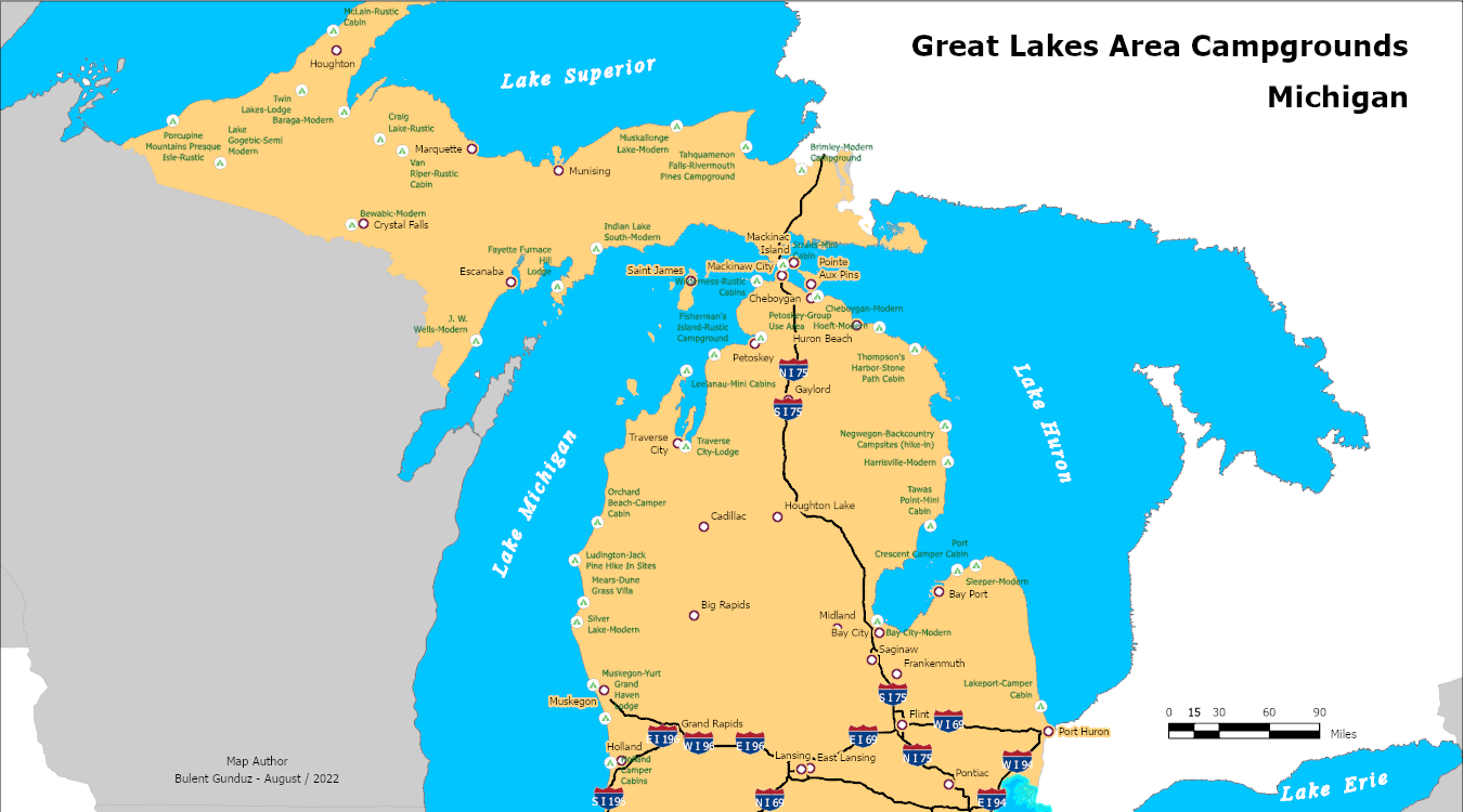
Hello everyone. I have been dealing with ArcGIS for three days. Actually a very simple map took my three days. Of course there are reasons. For example this is my first map and I have not used ArcGIS before this course, plus, I had to find and decide what data to use. While creating the map I got some software issues too. So this is the map.
This map is honestly not what I wanted to create. For example I tried to add the State Routes but I could not use that data. When I tried to export it to PDF the software did not respond. I tried a couples of time including one of them was an hour of waiting time, annoying. So I had to remove that data from my map. Also labels comes with the data table, if you take a close look interstates have two direction labels, North and South or Wes and East. I would like to edit some features but I could not find them. I am going to learn it.
I also purchased an ArcGIS user license for more practice without connecting the server. It is pretty slow sometime. My next maps are going to be better. I work hard for that. Thanks for reading.
Bulent
Comment (0)